
“The property has public water and sewer available.”
I’ve heard that statement hundreds of times throughout my career. It’s one of the most common selling points you’ll find in real estate listings, development packages, and conversations between buyers, brokers, and investors. At first glance, it sounds reassuring. If utilities are available, the property must be ready for development—or at least well on its way.
Not necessarily.
In fact, one of the first questions I ask when someone tells me a property has water and sewer available is, “What do you mean by available?”
It’s a simple question, but it’s one that often changes the entire conversation.
Over the years, I’ve found that people use the word available to mean very different things. A broker may simply mean there’s a public water line somewhere along the road. A property owner may have been told years ago that utilities were “close by.” A buyer may assume that because a neighboring parcel has service, their property can be connected just as easily.
Sometimes those assumptions are correct.
Many times they aren’t.
I’ve spent much of my career building water and sewer infrastructure throughout North Carolina, and if there’s one lesson I’ve learned, it’s this:
A utility line on a map doesn’t tell you whether your project can be built.
I’ve seen water mains located directly in front of a property that still required costly public infrastructure improvements before service could be approved. I’ve seen sewer mains within a few hundred feet of a site that couldn’t provide gravity service because the existing pipe was too shallow. I’ve seen projects delayed for months because utility ownership, easements, or agency requirements weren’t fully understood before the property was purchased.
None of those challenges were obvious during the initial property search.
That’s because utility availability and utility feasibility are not the same thing.
One tells you that infrastructure exists.
The other tells you whether that infrastructure can actually support the development you’re planning to build.
That distinction may sound subtle, but it has a tremendous impact on project cost, schedule, and overall feasibility. It’s also one of the most common reasons developers, investors, builders, and landowners encounter unexpected expenses after closing.
In this article, I want to explain what “utilities are available” really means, why that phrase is so often misunderstood, and the questions every land buyer should ask before assuming a property is ready for development. Because when it comes to infrastructure, the goal isn’t simply to locate the nearest water or sewer line. The goal is determining whether those utilities can support your vision before you commit your time, money, and investment.
The First Thing I Look for Isn’t the Utility Line

When someone asks me to evaluate a piece of property, one of the first things they expect me to do is find the nearest water or sewer line. While that’s certainly part of the process, it isn’t where I begin.
I start by asking a different question:
What are you trying to build?
That question changes everything.
A two-bedroom home, a custom estate, a retail center, a fifty-unit apartment complex, and an industrial facility may all sit on the same parcel of land, yet each places vastly different demands on public infrastructure. Until I understand the proposed development, I can’t determine whether the existing utilities are adequate.
Think of it this way. Owning a pickup truck doesn’t automatically mean you can tow every trailer. Before you hitch anything together, you need to know the weight of the load, the towing capacity of the truck, and whether the equipment is designed for the job. Public utilities work much the same way. A water line may exist, but is it large enough? Can it provide the pressure and fire flow the project requires? Is there enough capacity in the system to support additional demand? Those questions can’t be answered by looking at a map alone.
The same principle applies to sanitary sewer. The presence of a sewer main doesn’t automatically mean your project can connect to it. Elevation plays a critical role. Gravity sewer systems rely on consistent slope, which means the depth of the existing sewer and the elevation of your proposed buildings are just as important as the distance between them. A sewer main located fifty feet away may be unusable if it sits too high to serve the site by gravity.
This is why experienced developers don’t evaluate utilities in isolation. They evaluate them in the context of the project they’re planning to build. The infrastructure must support the development—not simply exist nearby.
It’s also why I encourage clients to avoid asking, “Does this property have utilities?” Instead, ask, “Can these utilities support my project?”
That single change in perspective leads to much better conversations, better due diligence, and ultimately, better investment decisions.
A Water Line Nearby Doesn’t Guarantee Water Service
One of the most common assumptions I encounter is that if a public water line runs along the frontage of a property, obtaining service should be relatively straightforward. While that may be true for some projects, it’s far from a guarantee.
When I evaluate a site’s water service potential, I’m not simply looking for the closest pipe. I’m trying to determine whether that portion of the public system can reliably support the development that’s being proposed.
Several factors immediately come into play.
The size of the existing water main is important because it influences how much water the system can deliver. A smaller line may adequately serve a single residence but prove insufficient for a commercial development or a residential subdivision. The intended use of the property matters just as much as the location of the utility itself.
Fire protection is another consideration that is often overlooked. Many commercial buildings, multi-family developments, and even some residential projects must satisfy minimum fire flow requirements established by the local utility or fire marshal. A nearby water line doesn’t automatically mean those requirements can be met. If the existing system cannot provide the necessary flow or pressure, additional infrastructure improvements may be required before the project can move forward.
Pressure zones also deserve careful attention. Municipal water systems are designed to operate within specific pressure ranges, and crossing from one pressure zone to another can introduce additional engineering requirements or system improvements. These aren’t issues that become obvious during a quick property visit, but they can significantly influence both design and construction costs.
Then there’s the practical question of where the connection can actually be made. Existing valves, line material, roadway crossings, and utility ownership all influence how a new service is installed. What appears to be a simple connection on a map may require coordination with multiple agencies, traffic control, specialized contractors, or improvements to the existing public system.
This is why I never describe a property as having “good water access” based solely on proximity to a water main. Proximity is only one piece of the evaluation. The real question is whether the existing system can provide the level of service your development requires without introducing unexpected costs or delays.
Water infrastructure isn’t simply about finding a place to connect. It’s about understanding whether that connection supports your project today, and whether it will continue to support it as the development grows.
Sanitary Sewer Is Where Many Projects Change
If water service is about capacity, sanitary sewer is about physics.
Unlike a public water system, which delivers water under pressure, most sanitary sewer systems depend on gravity. Wastewater must flow downhill from the building to the public sewer main, and that simple fact has enormous implications for land development.
When I evaluate a property’s sewer potential, I’m not asking whether there’s a sewer line nearby. I’m asking whether gravity can do its job.
That’s where many assumptions begin to fall apart.
I’ve looked at properties where the public sewer main was only a short distance away, yet the project still couldn’t connect because the existing sewer was too shallow. On another site, the distance wasn’t the issue, the building pad sat too low to allow gravity flow without significant redesign. In both cases, the sewer technically existed, but it couldn’t serve the project as originally envisioned.
Distance alone tells you very little.
The elevation of the proposed development, the depth of the existing sewer, the slope required to maintain proper flow, and the location of the connection all work together. Change one of those variables, and the entire utility strategy can change with it.
When gravity sewer isn’t possible, developers are often faced with difficult decisions. They may need to relocate buildings, regrade the site, extend the public sewer to a different location, or consider a private pump station. None of those options are necessarily impossible, but each carries additional cost, maintenance responsibilities, and long-term operational considerations that should be understood before the property is purchased.
This is one of the reasons I encourage clients to avoid making assumptions based solely on aerial maps or utility atlases. Those resources are incredibly valuable, but they don’t tell the whole story. Understanding whether a sewer can actually serve a project requires looking beyond its location and evaluating how the entire site functions together.
In my experience, sanitary sewer is often the utility that defines the development strategy. It influences building placement, grading, roadway design, stormwater layout, and overall project cost. That’s why I believe every serious development evaluation should begin with a simple but critical question:
Can this site be served by gravity sewer?
If the answer is yes, the project may move forward with confidence.
If the answer is no, the conversation changes, and it’s far better to have that conversation during due diligence than after engineering is complete or construction has already begun.
The Utility May Be There. That Doesn’t Mean You Can Reach It.
After we’ve determined that the existing water and sewer systems can support the proposed development, there’s another question that often surprises property owners:
Can we actually get to them?
At first, that may seem like an odd question. If the utility is located just across the road or a few hundred feet away, connecting to it shouldn’t be that difficult.
Unfortunately, development rarely works that way.
I’ve evaluated properties where the nearest water main was only a short distance away, but a four-lane highway separated the site from the utility. On another project, the sewer main was accessible only by crossing private property, which meant easements had to be negotiated before construction could even begin. I’ve also seen utility routes complicated by streams, railroads, protected environmental areas, and existing underground infrastructure that significantly changed the most practical connection point.
The utility itself wasn’t the problem.
Everything between the property and the utility was.
This is one of the reasons I encourage clients to think beyond straight-line distance. A utility may be only two hundred feet away on a map, but if that route requires crossing a state-maintained highway, directional drilling beneath a creek, acquiring easements from multiple property owners, or coordinating with several public agencies, those two hundred feet can quickly become one of the most expensive portions of the project.
Roadway crossings deserve particular attention. Connecting to utilities within or across a public roadway often requires permits, traffic control, pavement restoration, and coordination with the agency that owns the road. Depending on the location, that may involve a municipality, the North Carolina Department of Transportation, or another public entity. Each has its own standards, review process, and construction requirements.
Private easements can be just as challenging. Even when an easement appears feasible on paper, it still requires cooperation from the affected property owners. Negotiating access takes time, legal documentation, and occasionally financial compensation. Until those agreements are secured, a proposed utility route remains just that—a proposal.
These are the kinds of issues that rarely appear in a property listing, yet they often have a greater impact on project cost than the utilities themselves. It’s not enough to identify where the infrastructure exists. You also have to determine the most practical, economical, and approvable path to reach it.
One of the questions I ask during every feasibility review is surprisingly simple:
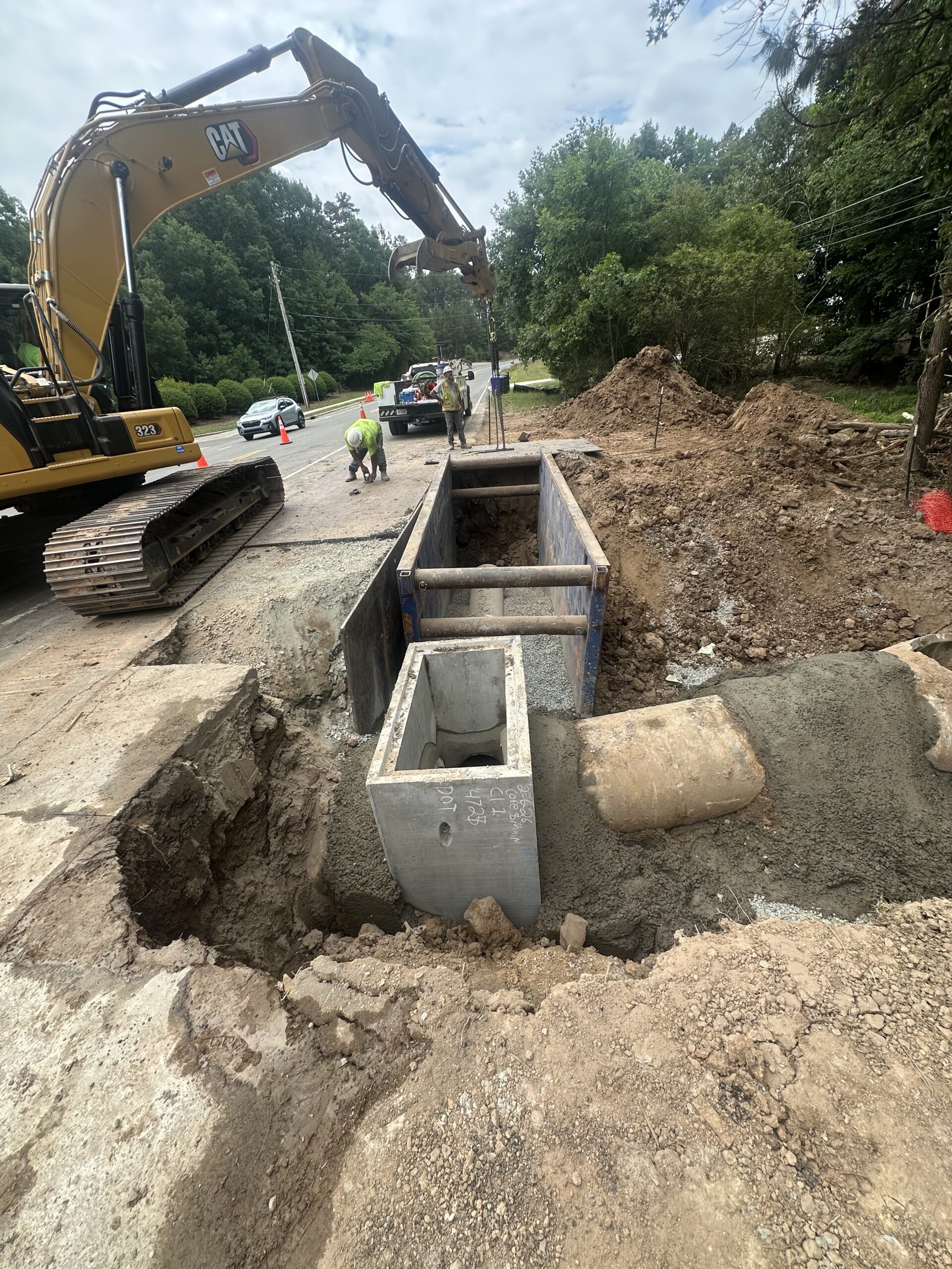
“If I were standing in an excavator tomorrow morning, how would I install this utility?”
That question forces me to think beyond maps and into construction. It requires considering traffic, existing utilities, property boundaries, environmental constraints, permitting, and constructability all at the same time.
Because in the end, utilities don’t connect themselves.
Someone has to build them.
And understanding how they’ll be built is often just as important as knowing where they’re located.
The Right Question Changes Everything
Throughout my career, I’ve learned that successful development rarely comes down to luck. It comes down to preparation. The developers who consistently make sound decisions aren’t necessarily the ones with the largest budgets or the most experience—they’re the ones who take the time to understand what a property truly requires before they commit to it.
When someone tells me a property has “utilities available,” I don’t hear an answer.
I hear the beginning of a conversation.
Can the existing water system support the proposed development? Can gravity sewer serve the site? Are there easements, roadway crossings, or agency requirements that will affect construction? Who pays for the necessary improvements? Those are the questions that determine whether a property is ready for development, not the presence of a utility line on a map.
That’s why I encourage every land buyer, developer, builder, and investor to slow down before making assumptions. A little extra due diligence during the acquisition process can prevent months of delays, unexpected costs, and difficult decisions later. More importantly, it gives you the confidence to move forward knowing your investment is based on facts rather than optimism.
At SL Advisory, that’s exactly what we help our clients do. We don’t simply identify where utilities are located. We evaluate whether they can realistically support your vision, what obstacles may stand in the way, and what it will take to move from raw land to a successful development.
Because utility availability and utility feasibility are not the same thing.
And understanding that difference may be one of the most valuable investments you make before purchasing your next piece of property.